
Tsawout Nation Belly-Rising-Up site, Saanich, British Columbia 24 April, 2005 photo by Gordon Brent Ingram
")
The ‘Belly-Rising-Up’ site is on the Tsawout First Nation lands on the east coast of the Saanich Peninsula on south-eastern Vancouver Island just north of Victoria, British Columbia. Belly-Rising-Up is part of an Indian Reserve negotiated in the early 1850s as part of one of the few Douglas Treaties. Belly-Rising-Up is an extremely important location not only for Canadian and West Coast history and politics but for cultural and social futures.

This seemingly natural ecosystem has an exceptional array and density of food plants crucial to Salish communities — that can only result from careful protection, harvesting and management. Belly-Rising-Up was one of the subjects of the Douglas Treaty negotiations in part because of the importance of these (agri)cultural sites to the Tsawout people. But in the ensuing century and half, knowledge and appreciation of these food production landscapes, indeed of Salish agriculture in general, has largely declined. The remaining knowledge of the Tsawout is as precious as are the demonstrative features and genetic resources of the site. So the strategic importance of the Belly-Rising-Up site, that continues to be protected and managed by the Tsawout First Nations, extends to new research and as an example for new land management initiatives that more squarely acknowledge and actively involve the leadership of aboriginal stewards and governments.

Tsawout Nation tea-house and treaty sign, Saanich, British Columbia 23 July, 2004 by Gordon Brent Ingram
While I visited the beach area adjacent to this rock and marsh since I was a young child, I did not actually visit the Belly-Rising -Up site until about 2000. An older friend, celebrated artist Michael Morris, grew up on the east coast of the Saanich Peninsula and mentioned to me of his encountering a Salish healer at Belly-Rising-Up decades back. This person spoke of the rough English-translation of the Tsawout name and the cultural importance of the place.
 Belly-Rising-Up from a recent subdivision to the south, July 2004 by Gordon Brent Ingram
 Beach at Belly-Rising-Up 30 June 2006 by Gordon Brent Ingram
So while new to this Tsawout protected area, my formative experiences were a few miles due west on the west side of Central Saanich: adjacent to and inside of the Tsartlip First Nation‘s Douglas Treaty lands in Brentwood Bay. So being introduced at a young age to traditional Tsartlip land management, for food plants especially the last of highly site-specific burning, there was something strongly familiar with what I found at Belly-Rising-Up; a quality about the place that was sometimes garden-like.
 Belly-Rising-Up with wetland and Garry oak, Quercus garryana, savanna, 30 June, 2006 by Gordon Brent Ingram
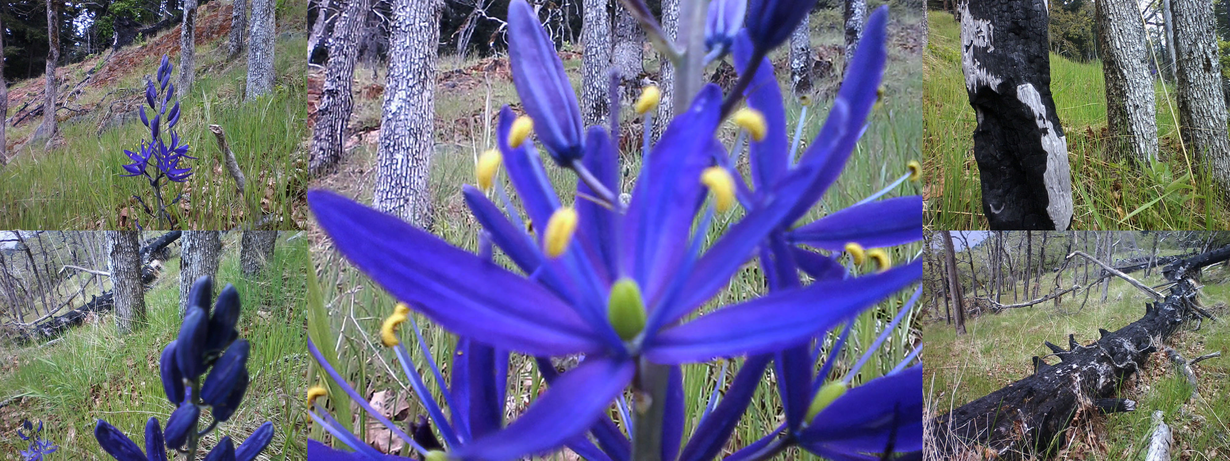
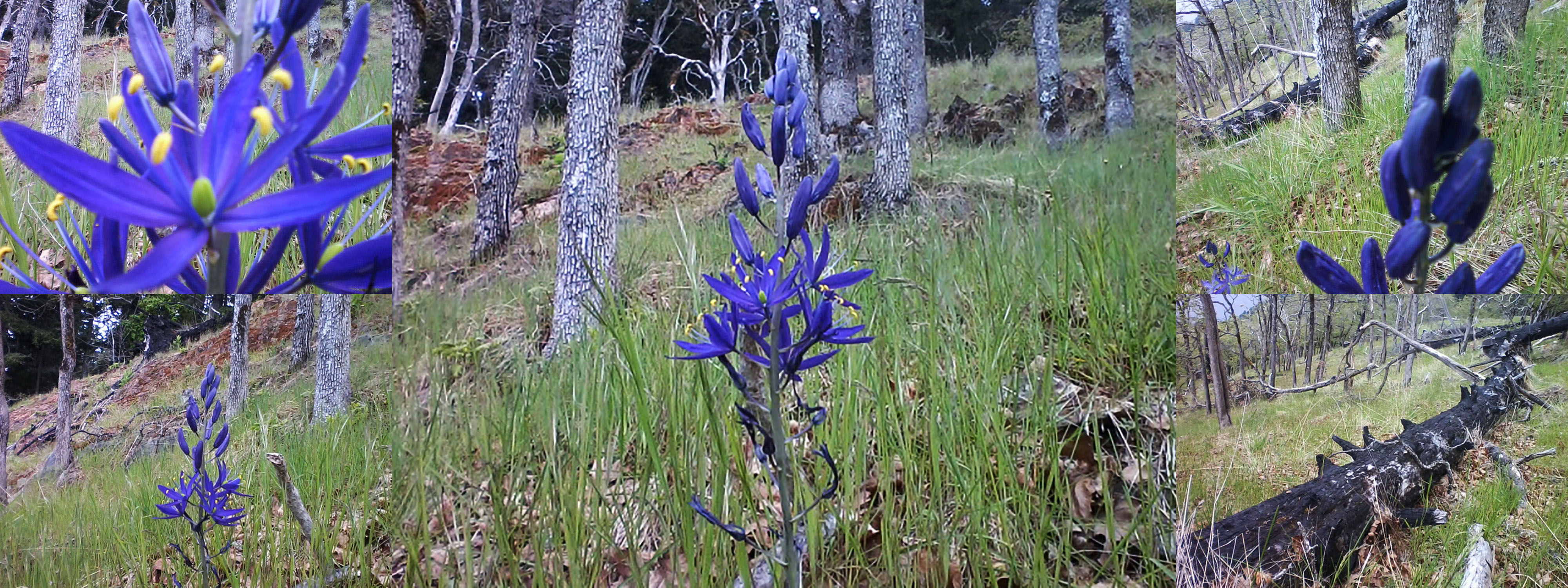
 camas, Camassia spp., Belly-Rising-Up 24 April, 2005 by Gordon Brent Ingram
 Berry, probably blackcap, cf Rubus leucodermis, 21 July, 2004 by Gordon Brent Ingram
 Saskatoon berry, Amelanchier alnifolia, Belly-Rising-Up, 21 June, 2004 by Gordon Brent Ingram
 flower of cinquefoil, Potentilla pacifica, Belly-Rising-Up, 30 June, 2006 by Gordon Brent Ingram
 freshwater habitat of cinquefoil, Potentilla pacifica, below Belly-Rising-Up 21 June, 2004 by Gordon Brent Ingram
 marsh habitat of cinquefoil, Potentilla pacifica, below Belly-Rising-Up 21 June 2004 by Gordon Brent Ingram
 marsh with cinquefoil, Potentilla pacifica, below Belly-Rising-Up 24 April, 2005 by Gordon Brent Ingram
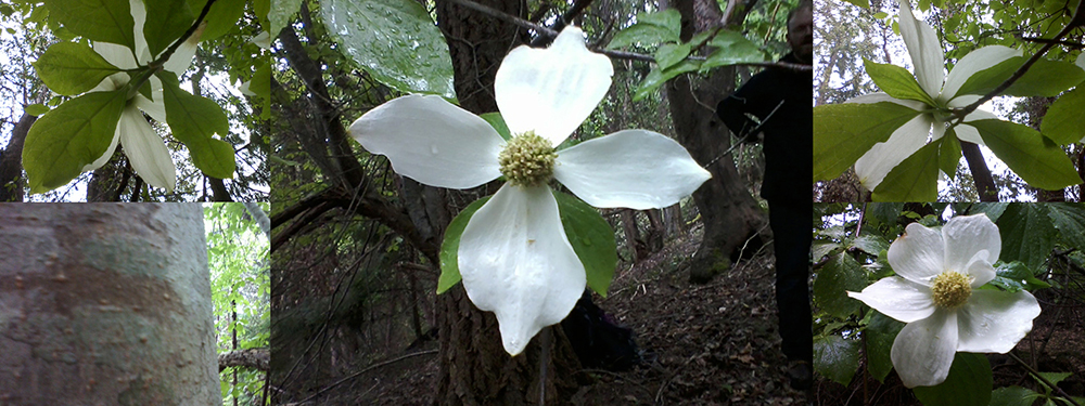
 crabapple, Malus spp., Belly-Rising-Up 24 April 2005 by Gordon Brent Ingram
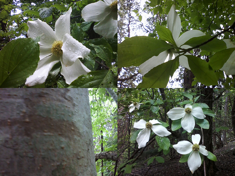
 crabapple, Malus spp., Belly-Rising-Up, 21 June 2004 by Gordon Brent Ingram
 Belly-Rising-Up 30 June 2006 by Gordon Brent Ingram") crabapple, Malus spp., below Belly-Rising-Up 30 June, 2006 by Gordon Brent Ingram
crabapple, Malus spp., below Belly-Rising-Up 30 June, 2006 by Gordon Brent Ingram
 crabapple, Malus spp., below Belly-Rising-Up 30 June 2006 by Gordon Brent Ingram
 chocolate lily, Fritallaria cf lanceolata, Belly-Rising-Up, 24 April, 2005 photo by Gordon Brent Ingram
 by Gordon Brent Ingram") chocolate lily, Fritallaria cf lanceolata, Belly-Rising-Up, 24 April, 2005 photo by Gordon Brent Ingram
chocolate lily, Fritallaria cf lanceolata, Belly-Rising-Up, 24 April, 2005 photo by Gordon Brent Ingram
 by Gordon Brent Ingram") chocolate lily, Fritallaria cf lanceolata, Belly-Rising-Up 24 April 2005 by Gordon Brent Ingram
chocolate lily, Fritallaria cf lanceolata, Belly-Rising-Up 24 April 2005 by Gordon Brent Ingram
 Garry oaks, Quercus garryana, with lichens, Belly-Rising-Up, 24 May, 2005 by Gordon Brent Ingram
 Garry oaks, Quercus garryana, on Belly-Rising-Up, 23 June, 2004 by Gordon Brent Ingram
 Lomatium nudicaule, below Belly-Rising-Up, 21 June, 2004 by Gordon Brent Ingram
 Lomatium nudicale, Belly-Rising-Up, 30 June 2006 by Gordon Brent Ingram
 red elderberry, Sambucus racemosa, Belly-Rising-Up, 21 June 2004 by Gordon Brent Ingram
 red elderberry flowers, Sambucus racemosa, Belly-Rising-Up, 24 April, 2005 by Gordon Brent Ingram
 wild rose, Rosa Nutkana, Belly-Rising-Up 30 June, 2006 by Gordon Brent Ingram
 sea lettuce, cf Porphyra perforata, 21 June 2004 Belly-Rising-Up by Gordon Brent Ingram
 sea lettuce, cf Porphyra perforata, 21 June 2004, Belly-Rising-Up by Gordon Brent Ingram
 Belly-Rising-Up 30 June 2006 by Gordon Brent Ingram") tule, cf Schoenoplectus acutus, below Belly-Rising-Up, 30 June, 2006 by Gordon Brent Ingram
tule, cf Schoenoplectus acutus, below Belly-Rising-Up, 30 June, 2006 by Gordon Brent Ingram
 tule, cf Schoenoplectus acutus, below Belly-Rising-Up, 30 June, 2006 by Gordon Brent Ingram
******
The proper spelling of the name of the Saanich people is,

in their language, which is most correctly spelled,

in which the name of the Tsawout people is spelled,

.


 June 1980 Gordon Brent Ingram(small)")
 storyboard 6 1980 Gordon Brent Ingram(small)")
")
 9 1979 Gordon Brent Ingram(small)")
 9 1979 Gordon Brent Ingram(small)")
 7 1979 Gordon Brent Ingram(small)")
 August 1978 Gordon Brent Ingram(small)")
 July 1979 Gordon Brent Ingram(small)")
 9 1979 Gordon Brent Ingram(small)")
")
 7 1979 Gordon Brent Ingram(small)")
")
 July 1979 Gordon Brent Ingram(small)")